I have been asked if a tornado can spin in the opposite direction of the normal counter-clockwise direction. The answer is yes! However, it is especially rare. It has occurred in our area. June 4, 2008 saw one in Jasper County.
On that June 4, 2008 day, we saw a different, non-traditional outbreak of severe weather & flash flooding. A band of HP supercells moving north along a warm front through the viewing area. A rare, anticyclonic mesocyclone & tornado positioned on the very front he of an HP supercell. Of all tornadoes in the U.S., anticyclonic twister only account for 1% of the total number. This tornado was spawned from one of these unusual left-moving HP supercells, striking Jasper County near Rensselaer to near Francesville in Pulaski County.
The band of supercells was moving due north to northwest, but the individual storms were moving northeastward. Anticyclonic tornadoes are rare & anticyclonic mesocyclones rarely produce tornadoes. Usually anticyclonic supercells distinctly split & move to the left of the main storm motion, deviating from the flow & parent supercell or they occur as a satellite tornado. Such tornadoes usually rotate around the parent usually strong to violent tornado within the same mesocyclone, but are usually short-lived. A satellite tornado is a sign of an EF3-EF5 tornado parent usually.
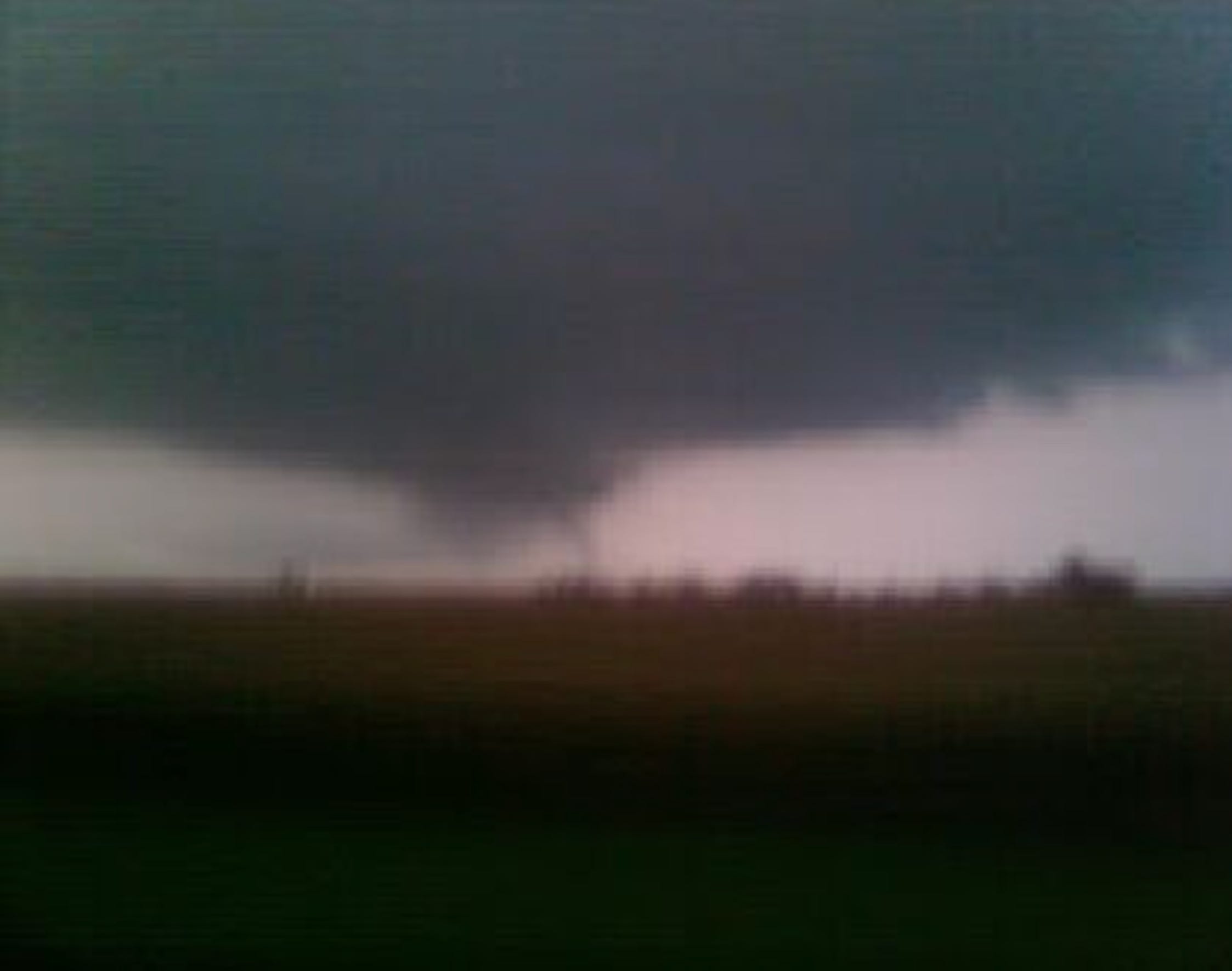
In this case, it was indeed a weak, smaller tornado at EF0, but it was not a satellite tornado & a splitting of a parent supercell was not particularly noted, making it an even rarer occurrence. Also, the tornado was within the main wall cloud of the storm, not a satellite tornado.
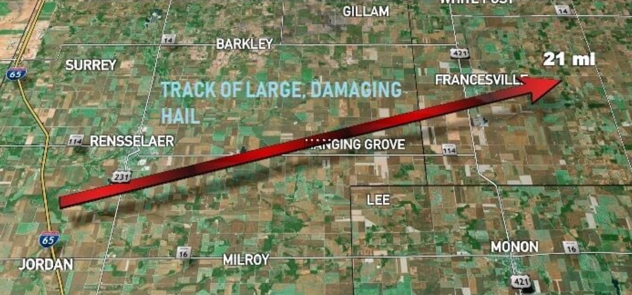
This supercell also produced a 21-mile swath of catastrophic crop damage, as well as vehicle, siding, window & vegetation damage from wind-driven hail up to tennis ball size.
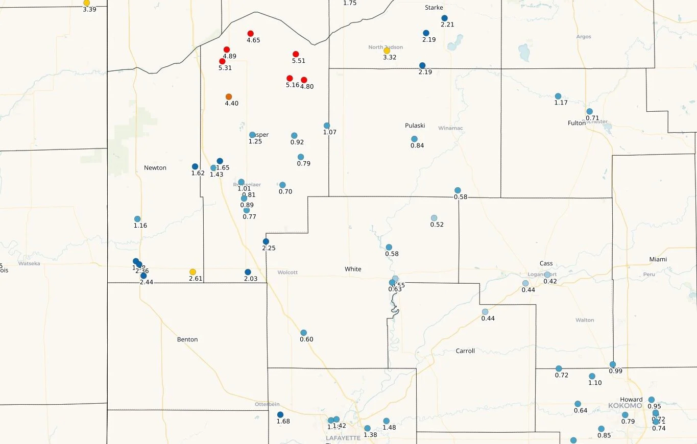
Flash flooding was significant with the storms with torrential rainfall rates on already-wet soils. Up to 5.31" of rainfall occurred in northern Jasper County.
CoCoRaHs rainfall totals:
Mt. Ayr CoCo observer stated this in the comments reports:
A strong storm boiled up right over us last night around 8:30-8:45 p.m. CDT. Rain was heavy at times and a tornado warning was issued for our county. Lightening was flashing like a strobe light as the storm traveled northeast of us. This morning winds are breezy from the south with overcast skies and 72 deg F. at 6:45 a.m. CDT.
Demotte observer:
72 degrees. Standing water everywhere in the field to my North. Electrical storm cut our power around 10:45 pm.
6 NW Royal Center observer:
Hail was reported from the SW corner of Pulaski County, IN to the NW corner, anywhere from 1/2" to 2" in size. I did not receive any hail at my location.
Monticello observer on the morning of June 5:
Mostly cloudy, humid, 73F, nice breeze, acts like it wants to rain. Rained off and on last night after sunset, awesome lightning and thunder but it went just north of us.
Observer southwest of Logansport:
We had a spectacular lightning show with some very loud thunder, not much rain but what a show.
Observer 2 miles northwest of Rochester reporting early on the morning of June 5:
Overcast sky, Temp is 77 degrees F, Barometer is 29.83 inches, Relative humidity is 83%. Had a Tornado warning last night, no damage no sightings. NWS reported 2.5 inch hail in Pulaski County,IN. The adjacent county west of my location. No flooding reported.
Report from Mary Anne in Remington:
We were under many warnings last night and the lightning was constant.
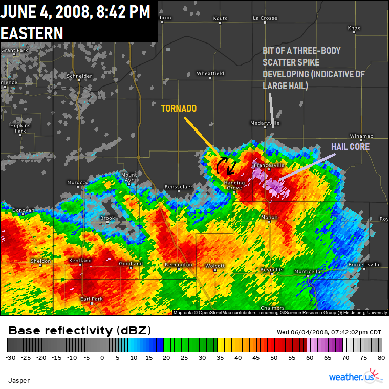
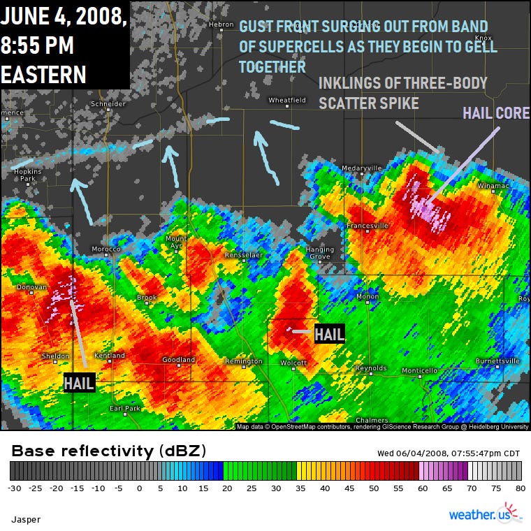
The supercell with the rare anticyclonic tornado & mesocyclone occurred oddly on the northeast part of the HP supercell northwest of the large hail core (with developing three-body scatter spike indicative of large hail).
This small EF0 tornado was viewed by spotters & reported 3 miles east of Rensselaer at 8:30 p.m., skipping all the way to north of Francesville on US 421. It eventually lifted south of Highway 39 & 14 intersection.
Another funnel was reported with a different storm at 8:46 p.m. southwest of Kentland near Raub (possible tornado) & another 3 miles south of Demotte at 12:27 a.m. A funnel cloud was first reported at Remington crossing the I-65/US 24 interchange at 8:13 p.m.
Nick Clayton & Roger Ness pic at I-65 & US 24 in our files from Remington at that time:
This was the Raub funnel & possible tornado from Benton County EMA at that time:
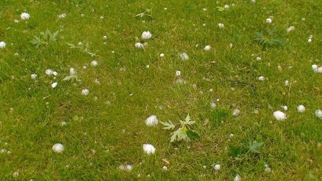
From Larry & Lisa Brady there from our archives near Francesville when the hail was already partially melted:
As the supercell begin a slight merger, note the hail core remaining, but also the gust front surging outward that did produced 58 mph gust.
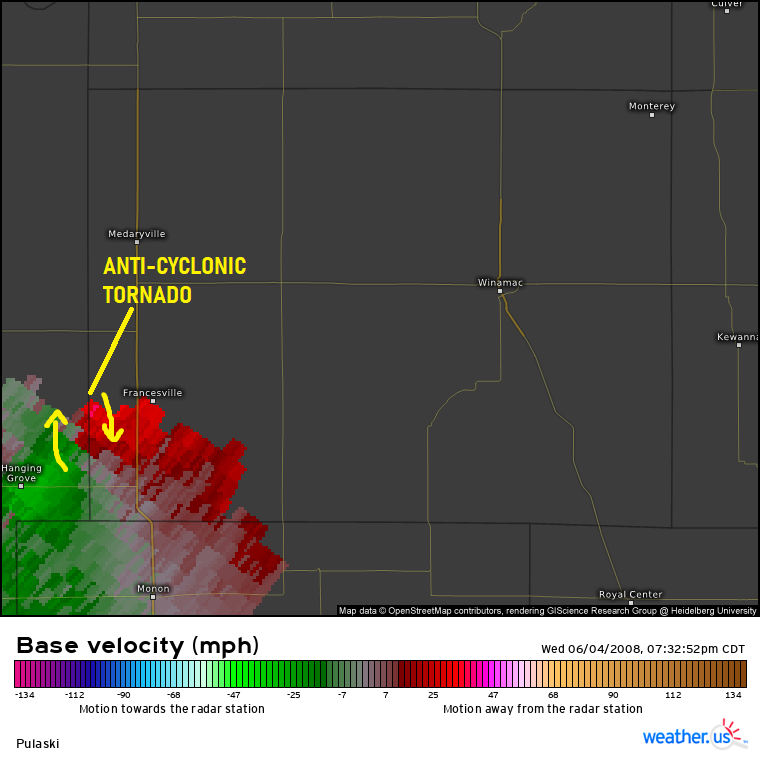
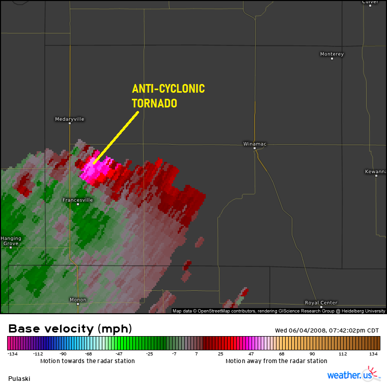
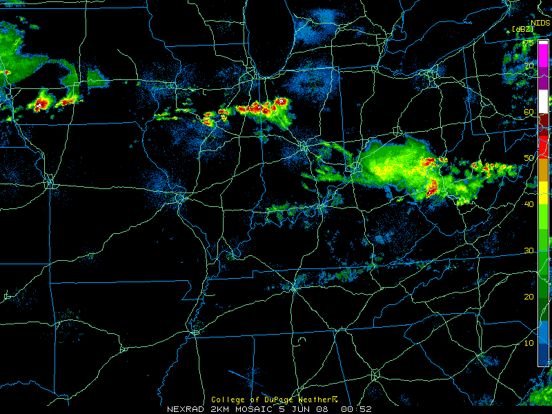
The mesocyclone & tornado as seen via Chicago-Romeoville NWS radar:
This is a wider view of the event via NWS radar imagery compiled by UCAR:
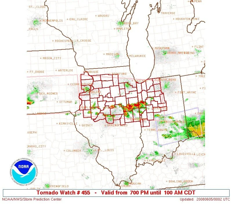
Tornado Watch was issued at 8 p.m. until 2 a.m. Eastern.
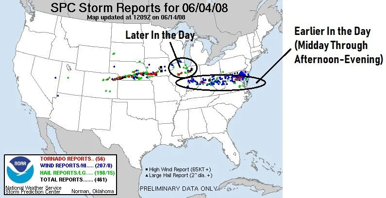
There are the storm reports from the clusters of severe storms earlier in the day south & southeast of our area & then the late day-evening storms here & the supercells & clusters of storms farther to the west.
The fact that the actual band of supercells was oriented west to east, moving north & northwestward & the individual storms were moving northeastward with some splitting in the storms shows the shear from strong upper jet. It is theorized that the strong mid & upper jet overcomes Earth's Coriolis to a degree to lead to this phenomenon. The orientation of the storms with the strong mid & upper jet was also a key to this rare storm.
Keep reading with a 7-day free trial
Subscribe to Chad’s Weather Blog to keep reading this post and get 7 days of free access to the full post archives.