Local Weather History: Palm Sunday-Like March 16, 1942 Tornado Outbreak In the Midwest ( But How A Supercell In Our Area Seemingly Spared Us)........
We saw damaging hail & wind here & possible tornado or two, but the violent tornadoes were all just northeast & west of our area & we were seemingly spared....
Friday is the 60th anniversary of the 1965 Palm Sunday Tornado Outbreak. Indeed, it was historic in its violence in our area, but other outbreaks have been similarly violent, like 1886, 1920, 1942, 1974 here. 1920 & 1942 are known for us seemingly lucking out of the violence, despite the outbreaks being historically-intense. There was severe weather with wind, hail & a few tornadoes, but the violent, long-track tornadoes seem to avoid the forecast area.
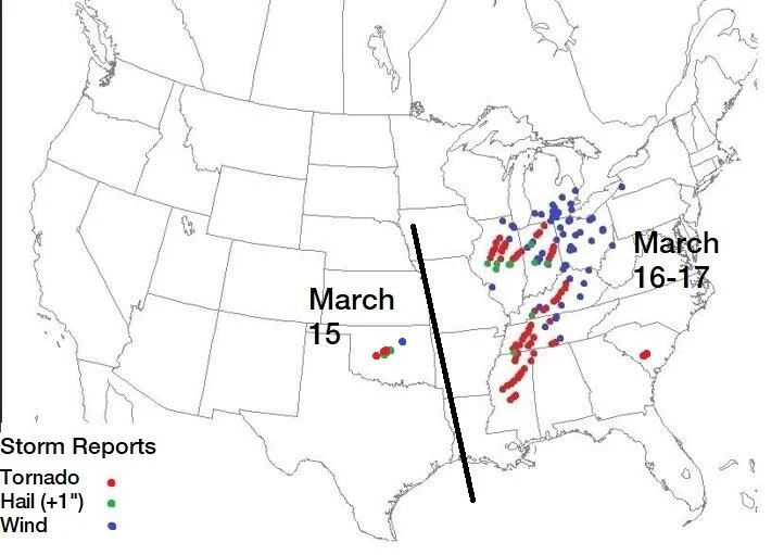
The major severe weather outbreak occurred March 15-17, 1942 over parts of the Plains to the Great Lakes & Midwest to the Southeast with numerous tornadoes, many long-track & strong to violent, along with large to very large hail & damaging winds. It bore resemblance in violence, synoptic set-up, evolution & spatial extent to the Palm Sunday Outbreak of 1920 & the Palm Sunday Outbreak of 1965.
What is so interesting is that not only in 1920, but also in the 1942 outbreaks, the viewing area was spared so much of the destruction. Obviously, this was not the case in 1965.
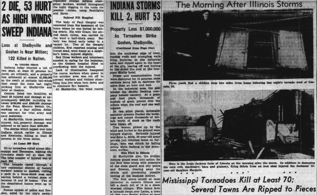
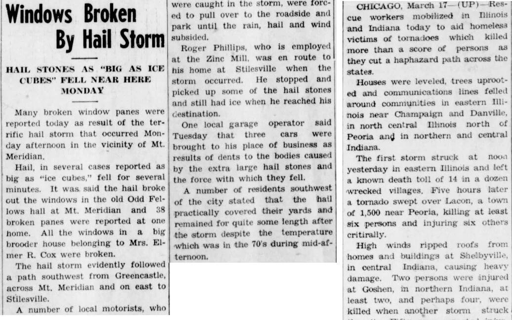
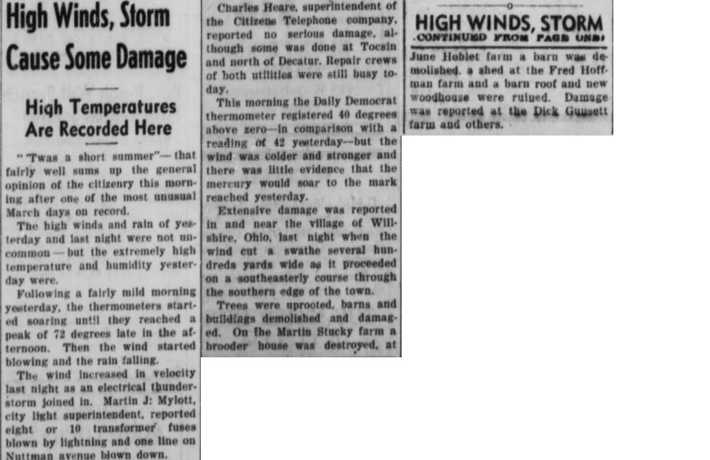
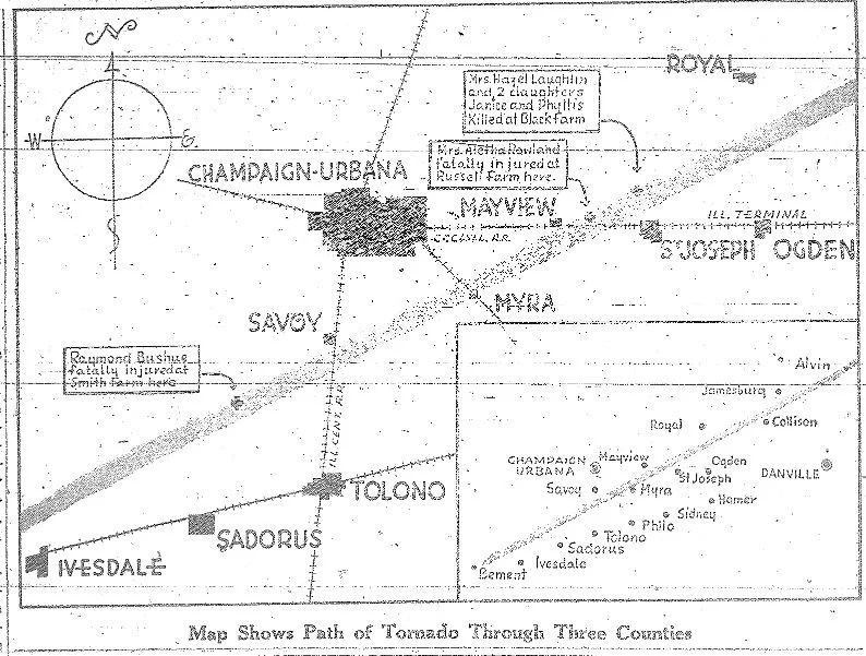
The images & stories of the outbreak were national & state headline news.
You can see the uncovered reports from the outbreak over the March 15-17, 1942 period.
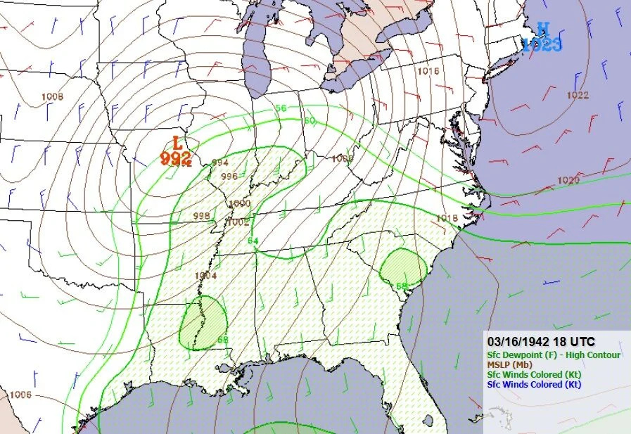
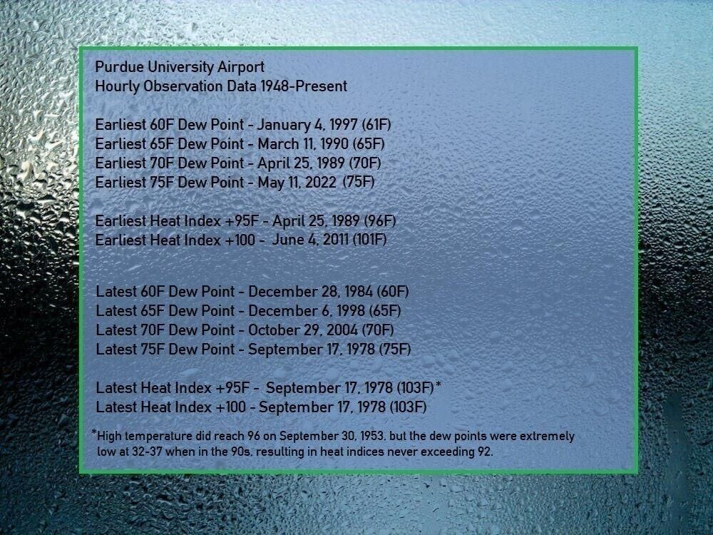
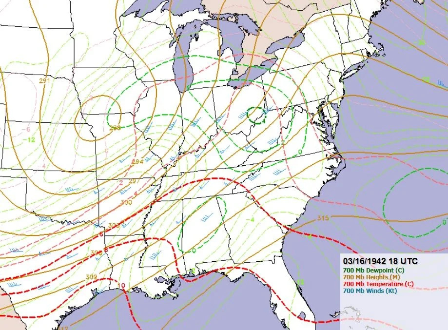
A deepening surface low tracked northwest of our area while +60 dew points were on the move northward. Very impressive +64 dew points reached as far north as I-70 in Indiana!
When we look at the earliest +60 & 65 dew points on record at the Purdue Airport we see that that +64 dew point likely ranked in one of the earliest on record so far north.
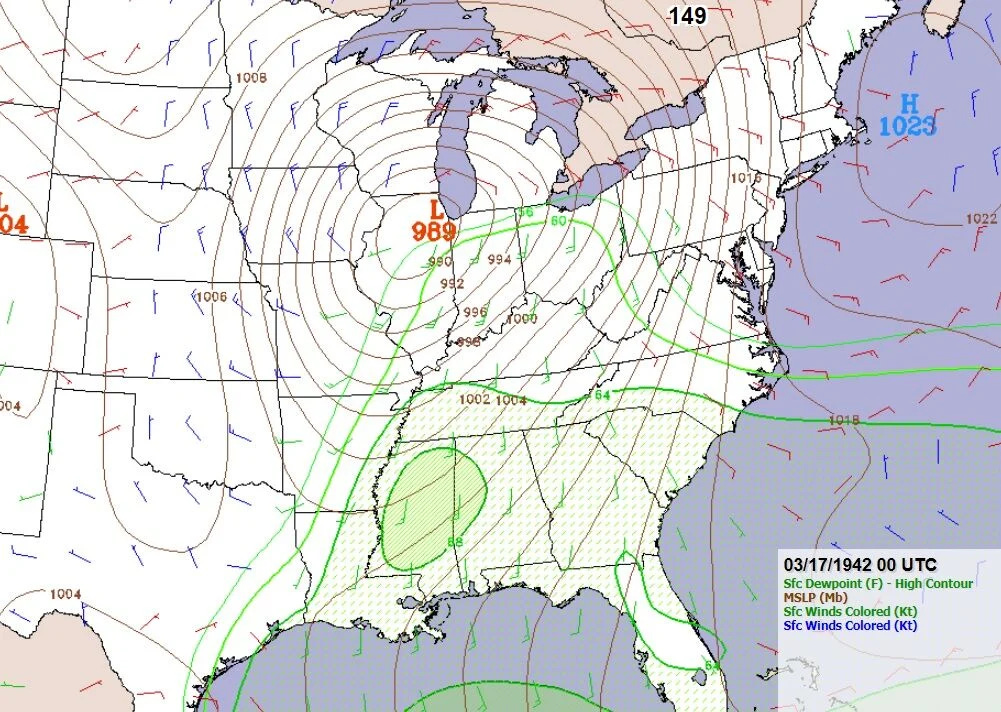
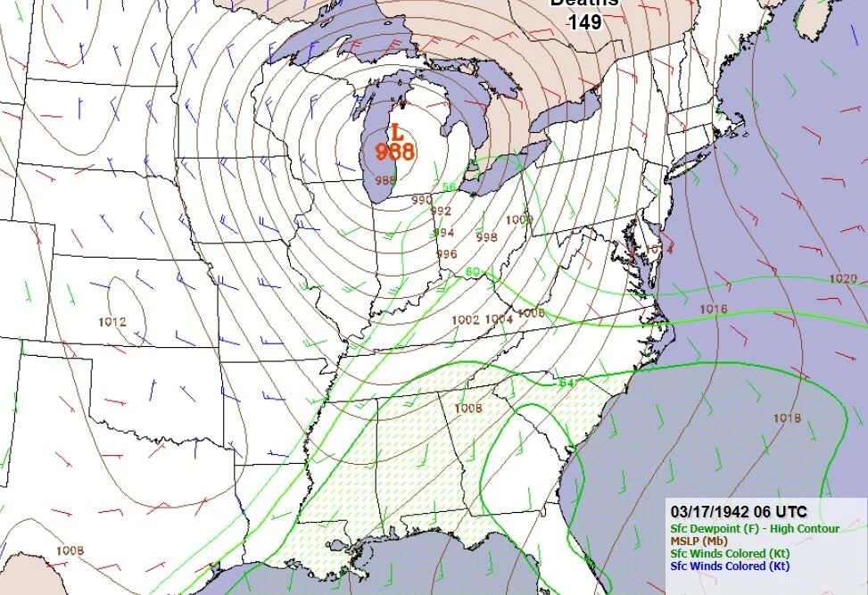
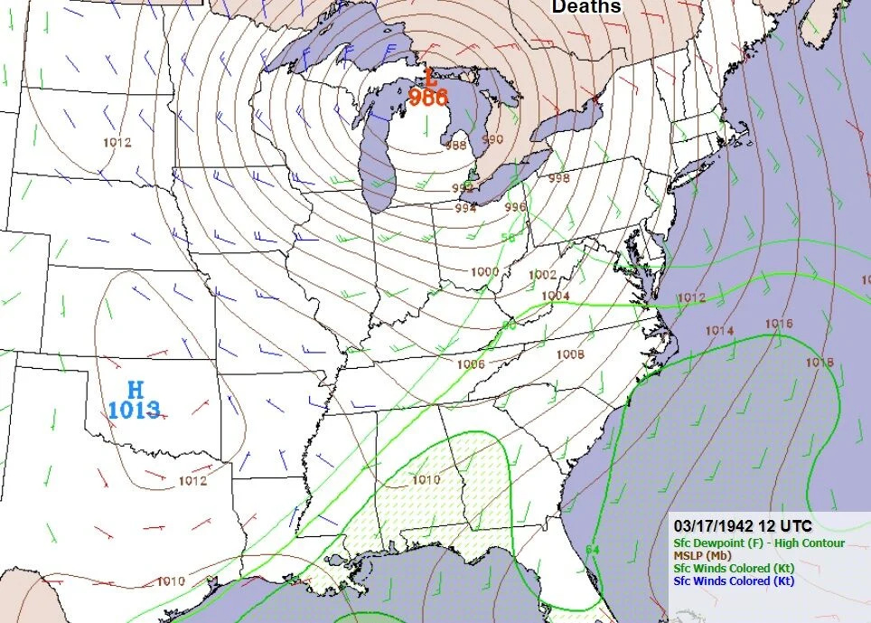
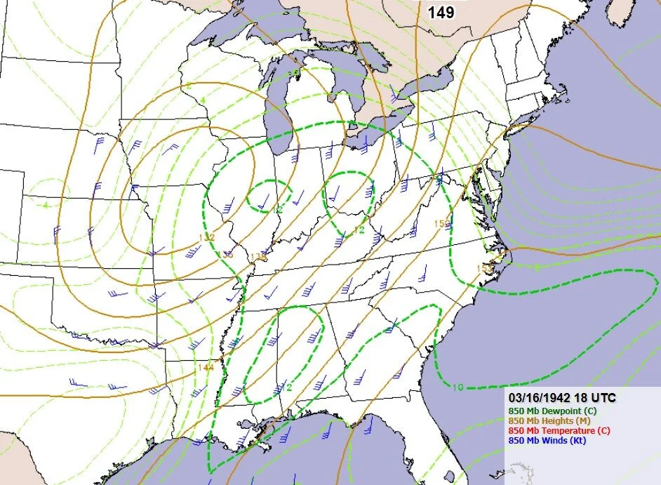
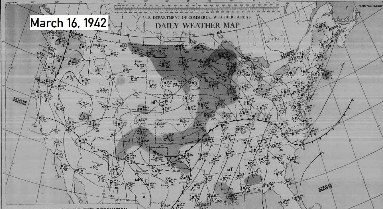
There is the deepening surface low down to an impressive 989 mb near Chicago on the evening of March 16, 1942.
Higher dew points are shunted southeastward with & best shear & dynamics migrating into Ontario by the afternoon of March 17. So, the outbreak pinches off over the Upper Ohio Valley & over the Northeast.
Howling northwest non-t'storm gradient Wind Advisory to High Wind Warning winds occur here with colder air on night of March 16-17, 1942.
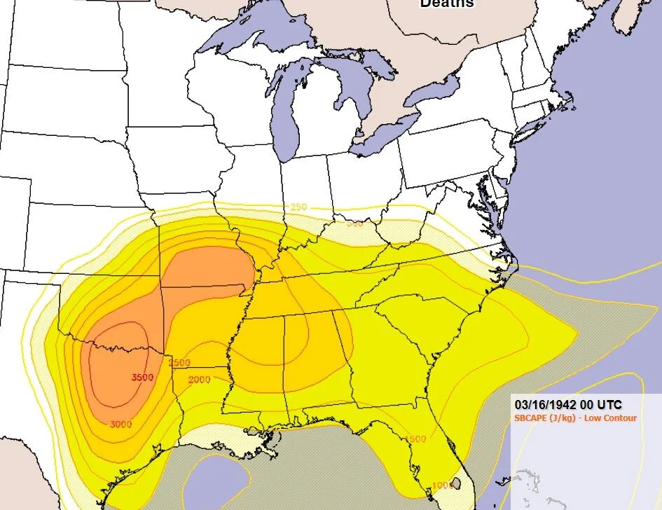
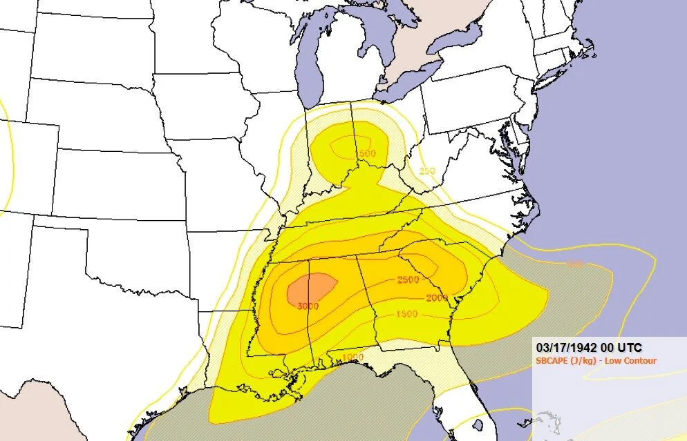
Surface CAPE or instability (energy for updrafts) on the move north & northeastward for the outbreak can seen below.
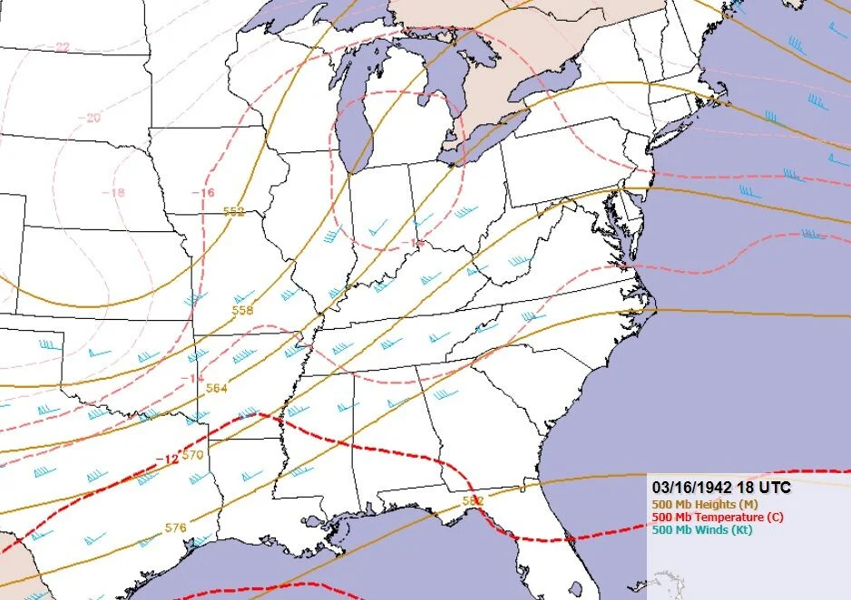
Note the -14C cold 500 mb temperatures, the high shear & the strong negatively-tilted (then positively-tilted upper trough) - some important ingredients to a violent outbreak:
Stats of outbreak:
149 deaths...........up to 1500 injured.........13 EF3s...........6 EF4s........1 EF5......7 EF2s.......EF0s & EF1s are unaccounted for, but evidence shows there were probably 12
So, this brings EF2-EF5 tornado count to 28, but the number of EF0s & EF1s evident likely brings the total up to at least 40 tornadoes.
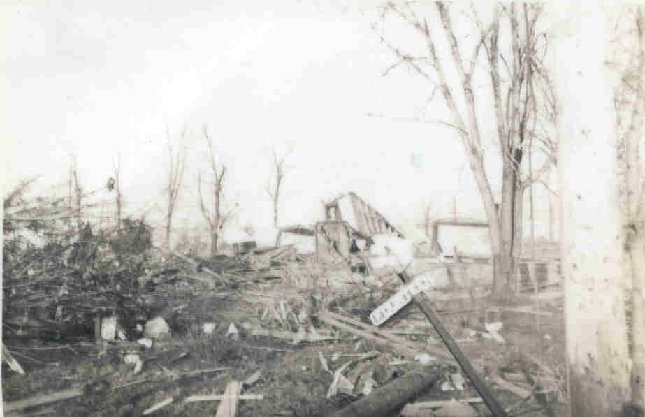
The EF5 near Peoria, Illinois was especially remarkable. This is the only EF5 evident in Illinois in the 1850-2024 since the Christian County EF5 April 24, 1880. Multiple homes near Lacon, Illinois completely disappeared in this tornado with debri reduced to shreds & splinters of wood. Severe tree debarking occurred & debri was lifted & tossed up to 25 miles.
Damage indicators in this tornado are similar to early reports in the March 20, 1866 southern Montgomery County tornado. This 1942 tornado tracked at least 30 miles, while there is evidence the 1866 tornado tracked 70 miles. The peak in strength northwest of Ladoga in southern Montgomery County, while the peak in strength with the 1942 tornado was northeast of Lacon, Illinois.
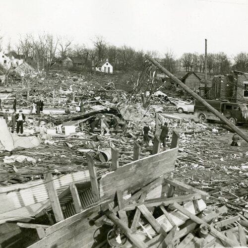
This is an image from the Lacon Tribune of the remnants of a huge 14-room home at Lacon, Illinois.
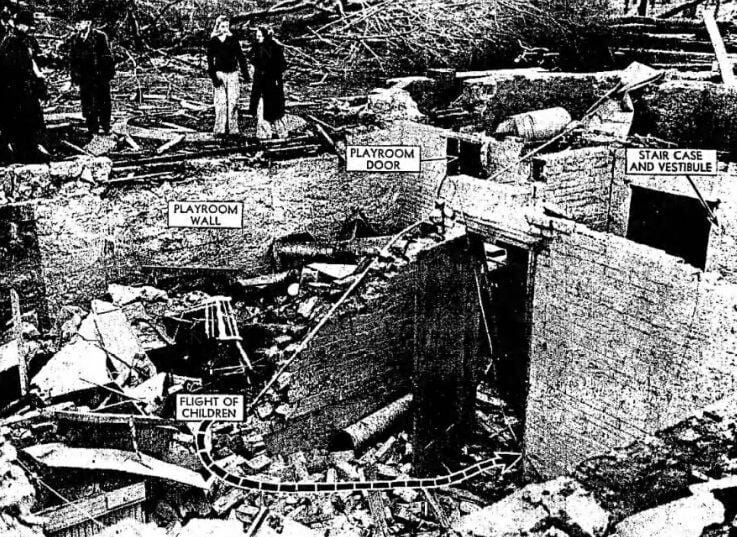
Goshen, Indiana tornado damage:
What is so fascinating is just how much our viewing area was spared the destruction.
We indeed had damage here from wind, hail, but were spared the true violence of the outbreak from very large hail, the tornadoes & extreme winds. No tornadoes were reported reported in the viewing, nor is there especial evidence of one touching down.
There was destruction across the state line in Vermilion County, Illinois. However, that tornado lifted before it crossed the state line into Warren County.
It was winds likely 60-75 mph, with episodic strips of quarter to golfball hail from north of Otterbein to near Chalmers & east of Royal Center to southwest of Rochester.
Back then & even now, EF0 & EF1 tornadoes were usually not documented unless they were actually seen. So, you usually see many more tornado numbers now compared to back then as likely 99% of tornadoes are accounted for. Some are merely small, brief EF0s that would have never have been documented, even in the 1970s.
However, the documentation of strong to violent tornadoes is pretty good as there as been consistent documentation of those way back into 1800s in Indiana (via settler accounts & early U.S. Weather Bureau to newspapers at the time).
I did the best I could to determine the highest measured t'storm gusts +40 mph (separating it from non-t'storm gusts):
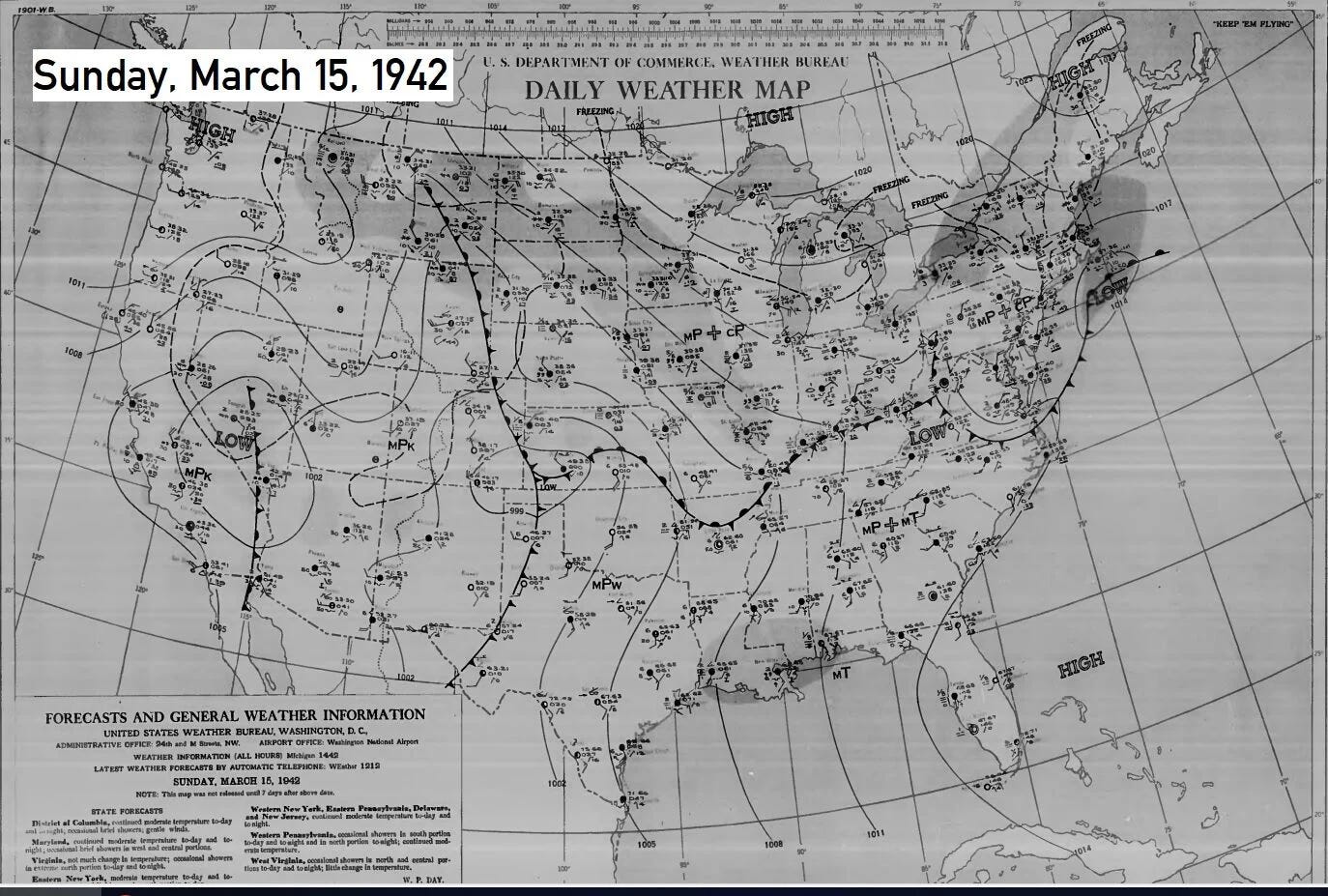
Here are the general surface maps from the U.S. Weather Bureau at that time. First, maps for March 15, 1942 are here:
March 16, 1942:
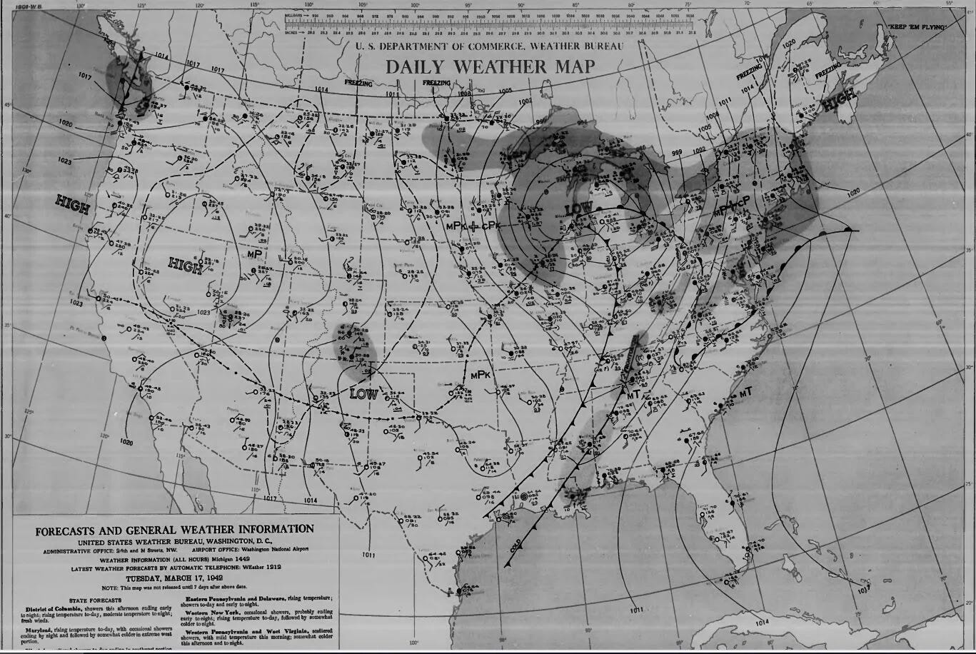
March 17, 1942:
I think what we can glean from all of this system is that the violent tornadoes in central Illinois were nearly completely atop the deep surface low, similar to what occurred with the Tri-State Tornado of 1925. The low deepened as it moved into Michigan, so it was not occluding with a triple point to enhanced tornado longevity & violence.
Rather, it seems to be that storms popping with the large hail & wind northeast of Terre Haute into Indianapolis that may have had a disruptive effect on inflow into our supercell. This thinking is ingrained observing previous outbreaks. It is only a hunch, rather than solid, meso- to microscale analysis from the time. Such a disruption may have teetered us from the brink of a tornado to more wind & hail. At the very least, if we had a brief rain-wrapped tornado, it was not like what occurred with this supercell in Illinois.
On a side note, this system also caused heavy, wet snow in southern Minnesota that down tree limbs & powerlines (though it was reported the snow was highly-beneficial in giving moisture as it was incredibly dry for the time of year), while highways & railroad tracks were reportedly washed out at Erie, Pennsylvania from flooding rainfall.
Keep reading with a 7-day free trial
Subscribe to Chad’s Weather Blog to keep reading this post and get 7 days of free access to the full post archives.